Sunday, August 31, 2008
Mt. Arkansas- 13,795 feet
 View of Mt. Arkansas from Freemont Pass. This was a good samaritan hike, to help two gentleman carry water for them, to enable them to hike with a lighter pack. For one of them this might be their last hike.
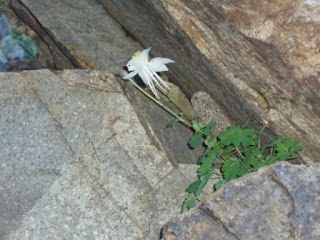
 There were beautiful wildflowers everywhere, especially the Columbines!
 Here's a view looking North at the Climax mine, which is being reopened shortly, amazing how they just cut down the mountainside.
Toby has a nose for those snow fields and this one in particular had a lovely orange hue, which made for some fun "war paint" as Brian put it for our hike up Tabeguache Peak.
And, yes we summited Tabeguache Peak, which is 14,155 feet tall. Tabeguache is a shortened name for a band of Utes called Mogwatavungwantsingwu, meaning "cedar-bark sun-slope people."
Mt. Shavano & Tabeguache Peaks Double Header!

As any good 14er hiker should do, we too started at o'dark thirty (as Ms. Sarah Heath would say) around 5 AM. Hiked a good consistent pace for three hours until we peaked Mt. Shavano.
Mt. Shavano is 14,229 feet tall, the southernmost fourteener in the Sawatch range, 15 miles northwest of Salida. Mt. Shavano was originally given the French spelling "Chavanaux", it was named after Ute Chief Shavano who signed a treaty with the United States."
Brian is standing near the sign in log.
Subscribe to:
Comments (Atom)


